Template:UgGPS
From Phidgets Support
GPS
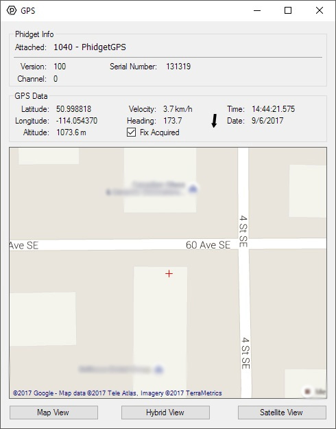
Double-click on the GPS object labelled PhidgetGPS in order to run the example:

General information about the selected object will be displayed at the top of the window. You can also experiment with the following functionality:
- GPS data will be displayed in real-time once a fix has been acquired.
- The Latitude label represents the current latitude position of the GPS antenna.
- The Longitude label represents the current longitude position of the GPS antenna.
- The Altitude label represents the current altitude of the GPS antenna in meters from mean sea level.
- The Velocity label represents the current speed over ground of the antenna in km/h.
- The Heading label represents the current true course over ground in degrees.
- The Time and Date label represents the current time as transmitted by the GPS receiver.
